- Forward


Remote Sensing
An Introduction


Prof. David Bernstein
James Madison University

Computer Science Department
bernstdh@jmu.edu

Print

Introduction
Back Forward
  • Remote Sensing Defined:
    • The science of acquiring information about a planet's surface using a device that is not in contact with that planet
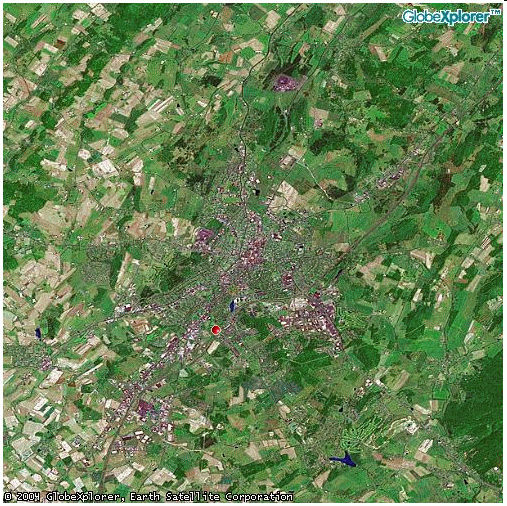
  • An Example:
    • images/harrisonburg-globexlporer.gif
The Participants and the Process
Back Forward
  • Energy Source:
    • Illuminates or provides electromagnetic energy
  • Radiation and the Atmosphere:
    • As the energy travels from its source to the planet it passes through the atmosphere
  • Interaction with the Planet:
    • Depends on the properties of both the "target" and the radiation
  • Sensor:
    • After the energy has been scattered by, or emitted from, the target, it is collected and recorded by a sensor
Energy Sources
Back Forward
  • Passive Systems:
    • Detect the naturally occurring energy (usually from the sun)
  • Active Systems:
    • Provide their own energy source (e.g., laser fluorosensors and a synthetic aperture radars)
Collection and Recording
Back Forward
  • Photographic:
    • Involves chemical reactions on the surface of light-sensitive film
  • Electronic:
    • Involves electrical/physical processes
Sensor Platforms
Back Forward
  • Ground-based platforms
  • Aircraft
  • Space craft and satellites
Resolution
Back Forward
  • Spatial:
    • Related to the instantaneous field of view
  • Spectral:
    • The ability of a sensor to define fine wavelength intervals
  • Radiometric:
    • Sensitivity to the magnitude of the electromagnetic energy
Sources/Causes of Distortion and Error
Back Forward
  • Perspective of the sensor
  • Motion of the scanning system
  • Platform altitude, attitude, and velocity
  • Terrain relief
  • Curvature and roatation of the planet
Uses of Remote Sensing
Back Forward
  • Photogrammetry:
    • Obtaining measurements or information
  • Planimetry:
    • Identifying and locating natural and man-made features
  • Stereogrammetry:
    • Extracting elevation information from stereo overlapping images
  • Interferometry:
    • Gathering elevation data using successive passes of synthetic aperture radars
  • Base and Thematic Maps
There's Always More to Learn
Back -