- Forward


Geodesy and Cartography
An Introduction


Prof. David Bernstein
James Madison University

Computer Science Department
bernstdh@jmu.edu

Print

Introduction
Back SMYC Forward
  • Geodesy:
    • The science of measuring and modeling the shape of the Earth
  • Cartography:
    • The science (and art) of communicating geodetic information using abstract visual representations (i.e., maps)
Map Components
Back SMYC Forward
  • Geographic Features:
    • Usually thought of as geometic shapes
  • Cartographic Elements:
    • Titles and explanatory text
    • Neatlines (i.e., borders and partitions)
    • Legends (i.e., descriptions of the symbols used to represent geographic elements
    • Scale
    • Orientation Symbol (e.g., a north arrow or compass)
Map Scale
Back SMYC Forward
  • Defined:
    • A statement about the relationship between a distance on the Earth and the equivalent distance on the map
  • Types:
    • Representative Fraction (e.g., 1:100000 indicates that 1cm on the map is 100,000cm on the Earth)
    • Word Statement
    • Graphic Scale
Map Resolution
Back SMYC Forward

The accuracy of a depicted location for a given map scale

Number of Dimensions Represented
Back SMYC Forward
  • Planimetric Maps:
    • Show only the surface features
  • Topographic Maps:
    • Show altitude/relief
    • Sometimes called hypsometric maps
Attributes and Statistical Data
Back SMYC Forward
  • Base/Reference Map:
    • A map of features only
    • Planimetric base maps are often called outline maps
    • Topographic base maps are often called mother maps
  • Thematic Map:
    • Shows the spatial distribution of one or more data sets
Classification of Thematic Maps
Back SMYC Forward
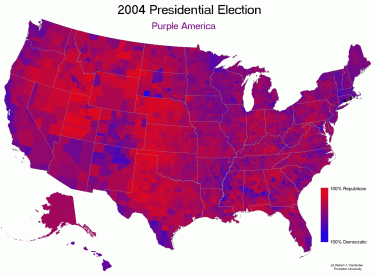
  • Choropleth Maps:
    • Features (usually areas) are colored, shaded, etc...
    • images/purpleamerica.gif
      Expand
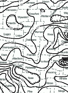
  • Isopleth Maps:
    • Consists of lines connecting locations of equal value
    • images/ohio-precipitation.gif
      Expand
Classification of Topographic Maps
Back SMYC Forward
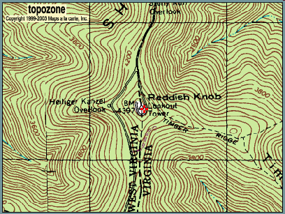
  • Contour Maps:
    • Use isolines for altitude
    • images/reddishknob-topozone.gif
      Expand
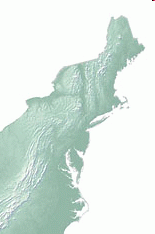
  • Tinted Topographic Maps:
    • Use hashing/shading/tinting
    • images/northeast.gif
      Expand
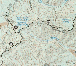
  • Hybrids:
    • Use both techniques
    • images/augusta-va.gif
      Expand
Applications
Back SMYC Forward
  • Political:
    • Borders of countries, states, etc...
  • Geological:
    • Structure and composition of geologic features
  • Biogeographical:
    • Location and movement of plants and animals
  • Physiographical:
    • "Ground cover" (forests, grassland, tundra, etc...)
  • Meteorological:
    • Weather and climate
  • Cadastral:
    • Layout of a town, city, etc... (sometimes called a plat or plan)
What We Need to Proceed
Back SMYC Forward
  • A coordinate system for the Earth
  • A coordinate system for the map
  • A way to convert from one to another (i.e., a projection)
  • A way to define and manpiulate geometric shapes
There's Always More to Learn
Back -